LiDAR to BIM for trees
Leveraging the benefits of BIM for existing trees
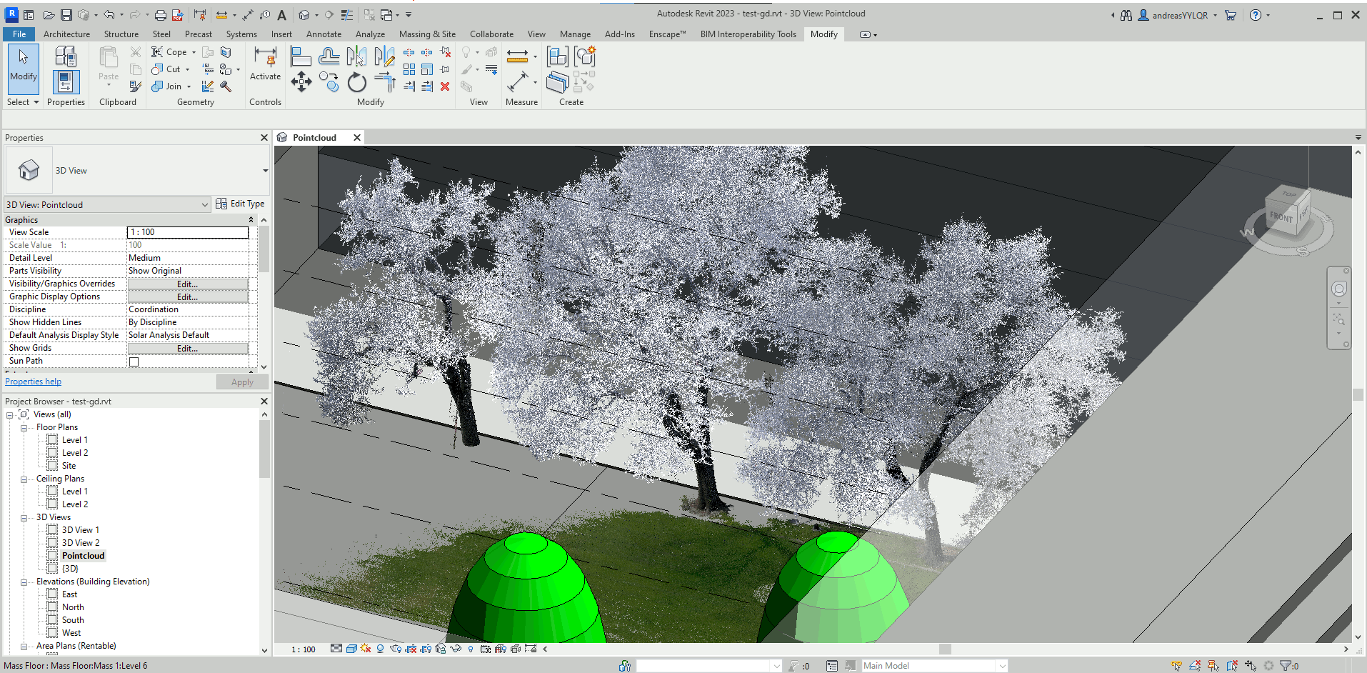
3D laser scanning is a higly efficent solution for landscape projects and tree inventories. The benefits of 3D scanning technology and data capture can be deployed efficiently, and help landscape professionals produce excellent work with less effort. Point clouds and scan data reliable as documentation so you plan and review projects, and avoid mistakes. Point cloud and model representation of trees and other plants provide an ultimate source of truth for your project or inventory. The raw scanner data, or 3D point cloud, can be used with software to view, pan, zoom, and rotate in 3D and obtain instant point to point measurements from. But point clouds have limitations and often heavy computational costs. They can not be used for for manifacturing or rendering since they do not include data on surfaces. Many analytical tasks like clash detection or solar analysis requiere BRep (boundary representation) models.
Ecosystem service analysis
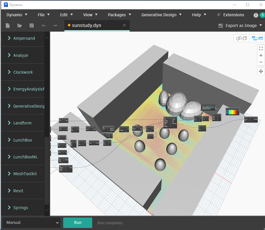
Trees provide numerous ecosystem services to moderate microclimates and improve environmental conditions, including carbon storage, reduction of rainwater runoff, pollutant filtering, shading, cooling, and mitigation of heat island effects. Methods for measuring and predicting tree dimensions, including the crown projection area, crown volume, and leaf area, enable arborists, planners, and researchers to model the growth and benefits of urban trees. The modeled trees from the point clouds are fully parametric and can simulate further growth for the skeleton and crown volume.