Landscape Design & Landscape Information Modeling
Put BIM into your Landscape
Put Landscape into your BIM

My Focus
Let's be honest, landscape designers try to avoid BIM, but sooner or later, your clients and cooperating partners expecting you to adapt, and you need to integrate it into your daily workflow.
I help landscape practices to establish the necessary workflows and to master BIM software. If you want to learn more about BIM and my service, contact me by phone or email.
LiDAR to BIM
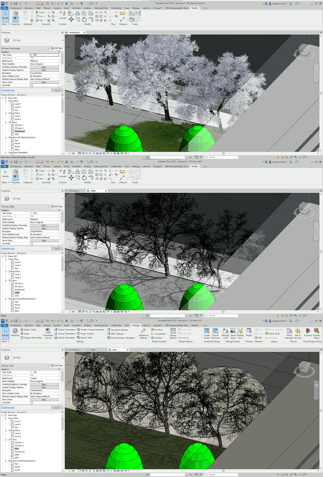
Laser scanning is an ideal technology for Building, Landscape and City Information Modeling (BIM/LIM/CIM) and creation of digital twins due to its efficiency, accuracy, and level of detail. Laser scanning accurately documents existing conditions, but point clouds from scans are hard to manage, modify or to analyze in BIM/LIM/CIM software.
I am developed a workflow to provide detailed volume models of the tree skeleton and an envelope model for the crown. Thise models can be used for clash detections,in scheduls for tree inventory, planting design and analysis of tree benefits and eco services (shadow, radiation and microclimate, carbon sequestration, pollutant removel and more).
bimTREE
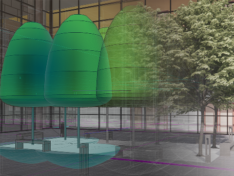
The bimTREE is a Digital Twin of a tree for his complete life circle, starting with the design in BIM environments, including performance analysis (CO2 sequestration, i.e. ). We can integrate the BIM model with a tree nursery's ERP system to create machine-readable labels for construction site management. We can finally transfer the BIM data into the landscape facility management system (GIS, tree cadaster).
The bimTREE is vailable for test users, I have a set of 5 trees with some selected sizes (free) and a set with about 50 trees and large shrubs with tree nursery stock information for Switzerland (license fee). Please contact me at andreas.luka (at) alcbim.de
bimTrees for outdoor comfort analysis
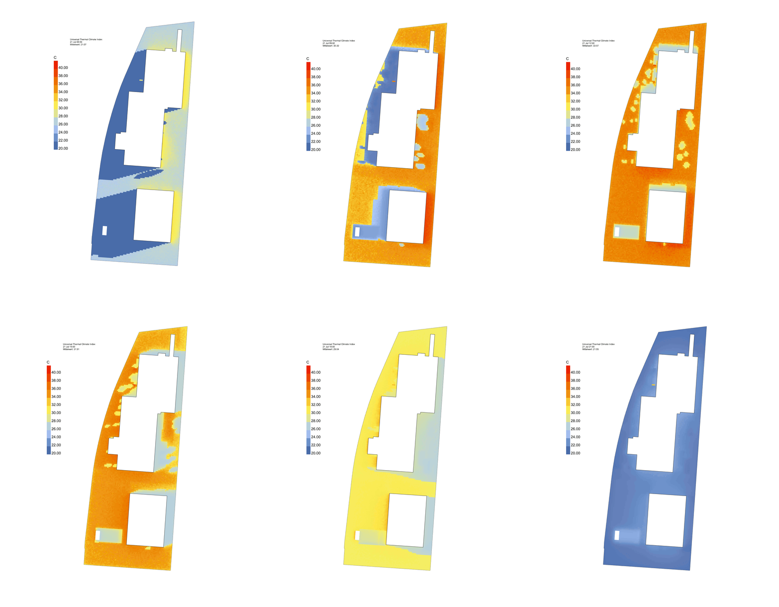
Trees have a major impact for outdoor comfort. The use of bimTrees allows the analysis of outddor thermal comfort or percived temperature (measured as Universal Thermal Comfort Index - UTCI) over long time taking realistic form and growth of existing and newly planted tree species into account. The image shows the UTCI on a hot summer day from morning to evening in one hour steps for the current conditions.
In my workflow I integrated microclimate analysis tools from Rhino/Grasshopper (Ladybug tools) into BIM models using RhinoInsideRevit. The model of the sourounding environment was entirly build from SwissTopo data utilising DynaGIS and DynaTopos nodes.
DynaTopos
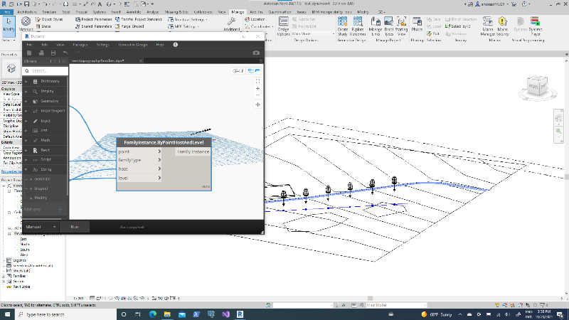
A collection of Zero Touch Dynamo nodes for TopoSurfaces. This package includes nodes to expose attributes and values for linked topographies, topographies, building pads, and site subregions. It also inculed nodes for placing families correctly hosted on surfaces and by level. For placing objects, I developed nodes for random and quasirandom points in polycurves.
The DynaTopos is available via Dynamo packages for all Dynamo users. If you have questions please contact me at andreas.luka (at) alcbim.de
DynaGIS
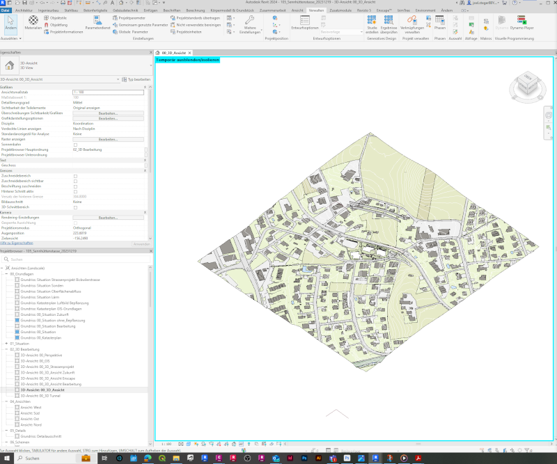
A collection of Zero Touch Dynamo nodes for integration of GIS data directly in Revit. This package includes nodes to read ESRI shape and GeoJSON files and translocate them into correct position based on the GIS dtata projection and Revits's project coordinate system. The polygon shapes representing landuse are mapped by using DynaTopos nodes to a toposurface, build from a classified pointcloud. Pointcloudes and shape files are automatically downloaded using public API's from SwissTopo.
The DynaGIS is available via Dynamo packages for all Revit/Dynamo users. A version for Civil3D is work in progress. If you have questions please contact me at andreas.luka (at) alcbim.de